

More magnificent May weather for NJ: Only one rain chance this week
The Bottom Line
Did you like the weather on Mother's Day Sunday? If so, you'll love Monday's forecast. I have opted for a copy-paste forecast here — called "persistence" — keeping the beautiful conditions going for one more day. I am loving the sunshine, blue skies, light breeze, dry weather, and mild temperatures.
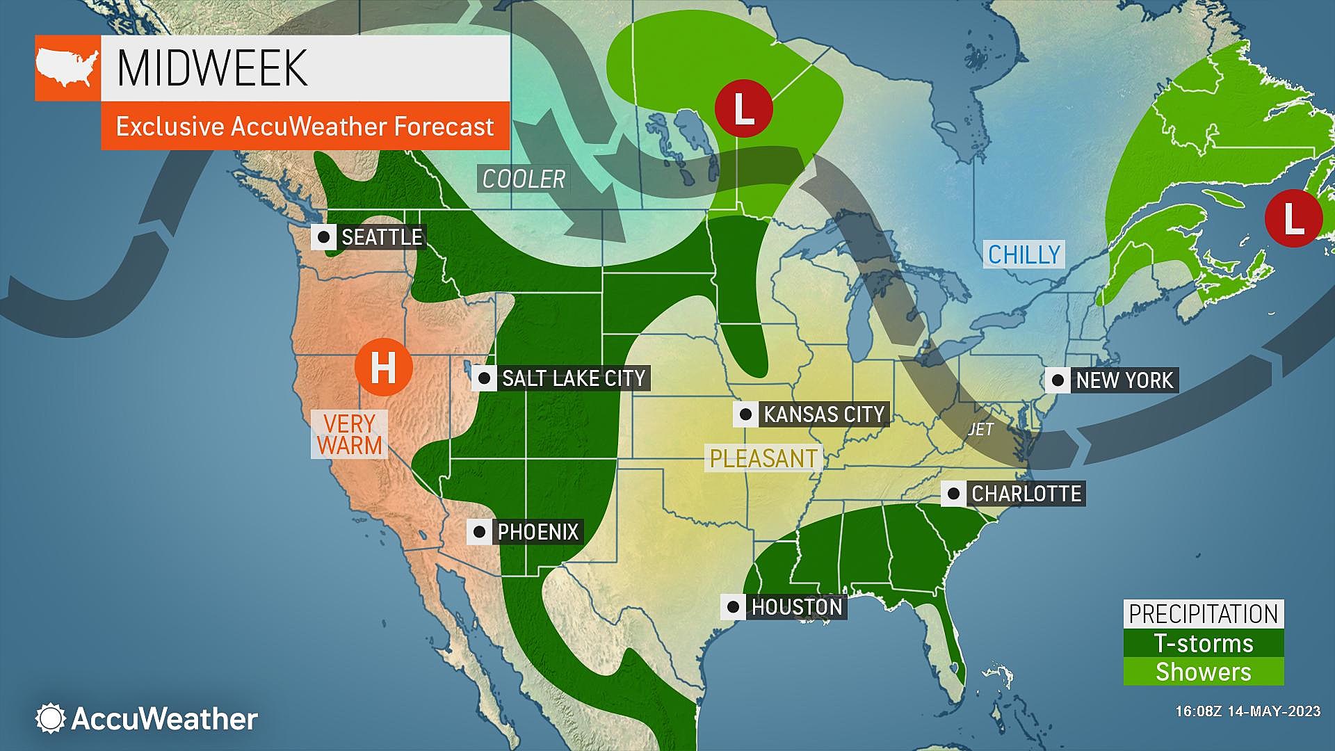
Tuesday is the one speed bump of the week, as our weather turns a bit murky. Clouds roll in. And it will be our one and only one rain chance of the workweek.
Behind that storm system, cooler temperatures settle in with a fresh breeze starting on Wednesday. Sunshine will return. But temperatures will hold just below seasonal normals for several days.

Monday
No weather concerns and no weather complaints to be found.
We are starting the day with a seasonable chill in the air, as temperatures are on either side of 50 degrees. You'll probably want to grab a jacket on your way out the door.
High temperatures Monday will aim for about 70 to 75 degrees. Similar to Sunday. And close to or just above normal for the midpoint of May. A stronger land breeze will probably counteract the sea breeze effect Monday afternoon, allowing even Jersey Shore towns to hit 70+ degrees.
Although a band of clouds made a cameo appearance early Monday morning, the rest of the day should feature sunshine and bright blue skies.
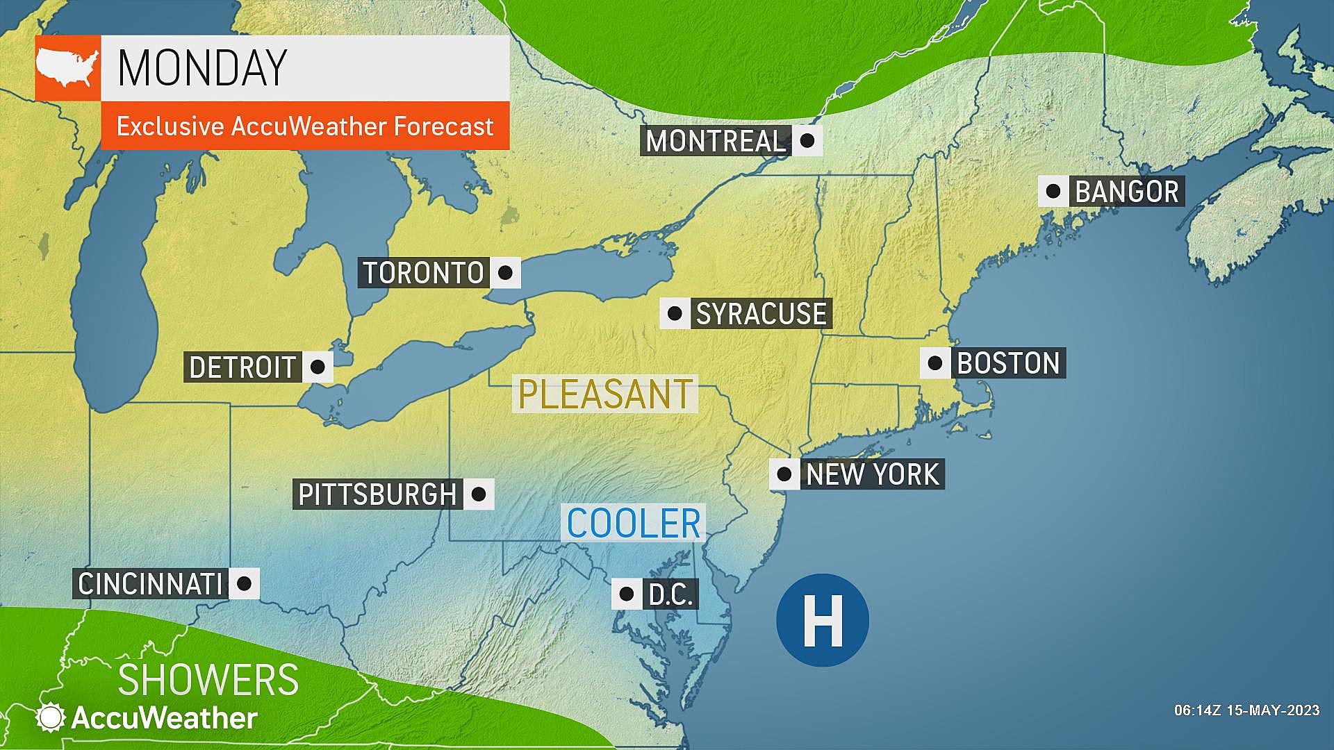
Monday night looks clear and calm, with temperatures slightly warmer than the night before. Lows will dip into the mid 50s. You may or may not need a light jacket, depending on how "thick" your skin is.
Tuesday
The warmest day of the week. But also our one shot of unsettled weather.
Skies will turn mostly cloudy by lunchtime. And you may notice some humidity in the air, as dew points push to 60 (especially in South Jersey).
High temperatures will hit about 75 to 80 degrees. That would make Tuesday the warmest day of the week, despite the increased cloud cover.
An atmospheric impulse is forecast to clip approximately the southern half of New Jersey late-day Tuesday. That means we could see spotty to scattered showers to the south, from Tuesday late afternoon through evening. Possibly lingering into early Wednesday morning too.
Don't expect much though. Guidance keeps total rainfall very limited, below a tenth of an inch, in South Jersey only. No lightning, no downpours, no severe weather concerns.
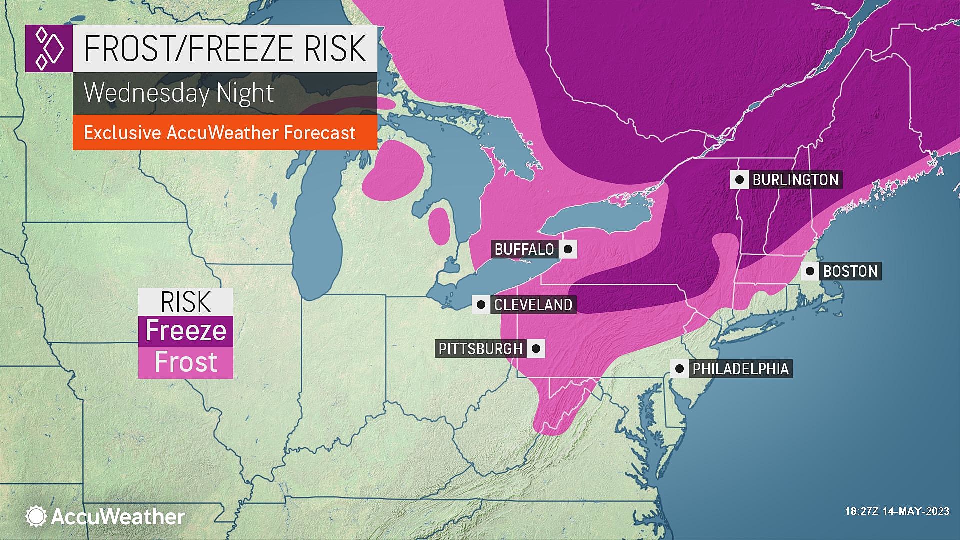
Wednesday
Wednesday will turn cooler. It will be especially noticeable thanks to a strong northwesterly breeze, gusting over 20 mph.
Highs on Wednesday will be limited to the mid 60s or so. Not bad at all. Especially since bright sunshine and dry conditions will return statewide.
Thursday
One important note: The growing season has probably started for most of the Garden State, meaning freezing temperatures are pretty rare going forward. However, the thermometer may creep into the 30s Thursday morning, especially around NW NJ. That is cold enough for some patchy frost, which could make your garden unhappy for a few hours.
Highs on Thursday will once again be limited to the 60s. Expect sunshine, a fresh breeze, very dry air, and completely dry weather.
Friday & Beyond
A wind shift on Friday — to a southeasterly breeze — will bring some subtle changes. A few clouds will pop in. Inland temperatures will push toward 70 degrees. But a more prominent sea breeze will keep coastal areas cooler (and potentially cloudier). Still dry and reasonably pleasant to close out the workweek.
Our next shot at a prominent storm system is in the late Saturday to Sunday time frame. Different models have different ideas about how prolonged and heavy that rain will be. I think it's a safe bet that everyone in New Jersey will get wet Saturday night, at least. There's a chance for inch-plus rainfall, which we could really use to keep drought parameters in check.
With that uncertain storm system plugged in for the weekend, it is impossible to get a confident view of next week's forecast. Can you believe the Memorial Day Weekend is only 12 days away?
Dan Zarrow is Chief Meteorologist for Townsquare Media New Jersey. Follow him on Facebook or Twitter for the latest forecast and realtime weather updates.
NJ street fairs return for the 2023 fall season
Gallery Credit: Mike Brant
26 of the Dumbest Laws in New Jersey
Gallery Credit: Matt Ryan
More From Lite 96.9 WFPG
