Another big soaker: Timeline of NJ’s next round of heavy rain
The Bottom Line
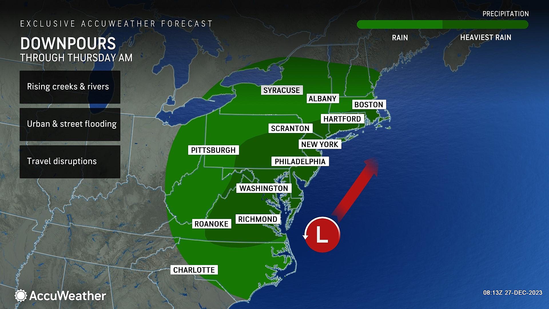
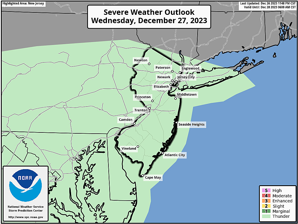
Wednesday turns wet. Especially Wednesday night. A coastal storm system will drive in periods of rain throughout the day, with downpours likely in the evening and overnight hours. Rainfall estimates have nudged higher too — we are looking at 1 to 2 inches of widespread rain, with locally higher amounts to 3 inches.
So there will be big puddles, visibility and traction issues, and air travel headaches galore. But notice what's missing this time around: Ferocious winds, severe thunderstorms, coastal flooding, widespread flooding, wintry weather, etc. It's just wet.
Our weather stays unsettled through Thursday and Friday, with clouds, additional showers, and thermometers going nowhere. Breaks of sun return just in time for the New Year's weekend, as temperatures cool down slowly to more seasonable levels.

Wednesday
This will be a tricky travel day across New Jersey, with fog and rain making for inclement, wet weather.
As of this writing (6 a.m.), rain showers are now moving into the Garden State. Where it's not raining, it is foggy. Visibility is down to a quarter-mile in spots.
There will be breaks in the rain during the day Wednesday. But rain chances will only go up through the afternoon, as we eye a band of steady rain moving in eventually.
Meanwhile, it will stay overcast. I am promoting temperatures "around 50 degrees" once again — but reasonably, we will end up in the mid 40s in North Jersey and the mid 50s in South Jersey.
The brunt of the storm, with pockets of heavy rain, will kick in Wednesday evening. Starting between 7 p.m. and 11 p.m. We will get soaked through the overnight, with marginally gusty winds (up to 30 mph) and rumbles of thunder possible. Low temperatures will only dip into the upper 40s.
Thursday
Thursday morning's commute will be a close call, but I think rain will largely wrap up by about daybreak. There will still be some big puddles around and wet roads, of course.
Most of Thursday dries out, although an isolated shower will be possible at any time. We'll keep clouds and mild temperatures, pushing into the lower-mid 50s.
Friday
One more unsettled day. Another piece of energy will clip New Jersey, raising the chance of spotty rain showers throughout the day. At the same time, I could see some peeks of sun breaking through. High temperatures will probably hit about 50 degrees again, with cooler air leaking into our atmosphere as the day goes on.
Saturday
Nicer, drier, brighter weather arrives just in time for the weekend. Although it will turn cooler and more seasonable too.
This will not be an "arctic blast" kind of cooldown. Highs on Saturday should settle around the mid 40s — just a few degrees cooler than we have been all week. Definitely cold enough for a jacket or coat, especially as the occasional northwesterly wind blows.
The Extended Forecast
Sunday is New Year's Eve, Monday is New Year's Day.
And both days are looking pretty cool. Mornings will be pretty cold, potentially below freezing. Sunday will bring partly sunny skies and highs in the mid 40s. We could kick off 2024 in the 20s on Monday morning, moderating into the mid 40s again by the afternoon.
With cooler air in place, and colder air not too far away, the chance for wintry weather will be present in early to mid January. (As it often is, of course.) If a storm system comes along in the right spot, it could be a snow maker. Nothing in the next 7 days, at least. But we will be watching.
BEEP BEEP BEEP: These are the 13 types of Wireless Emergency Alerts auto-pushed to your phone
Gallery Credit: Dan Zarrow
Dan Zarrow is Chief Meteorologist for Townsquare Media New Jersey. Follow him on Facebook for the latest forecast and realtime weather updates.
BEEP BEEP BEEP: These are the 13 types of Wireless Emergency Alerts auto-pushed to your phone
Gallery Credit: Dan Zarrow
More From Lite 96.9 WFPG